


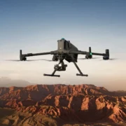
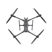


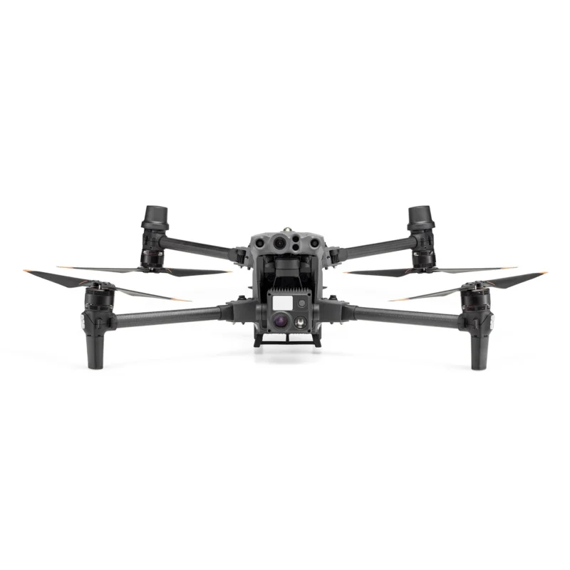
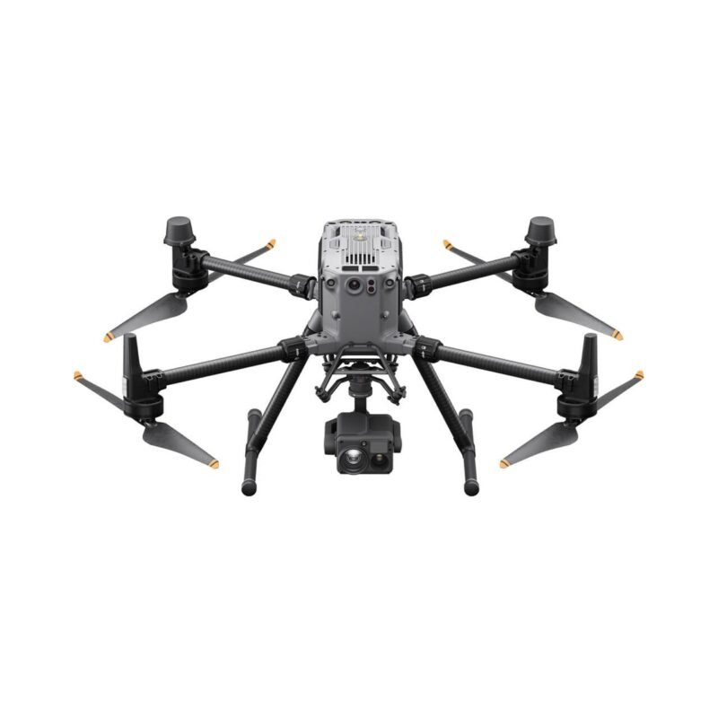
Transform commercial drone operations with the DJI M400, which can fly for up to 59 minutes, has a 6kg payload capacity, can carry up to 7 payloads, and is engineered for ship take-off and landing.
-
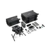
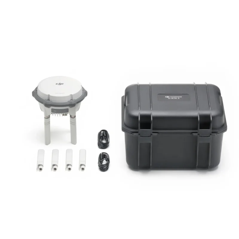
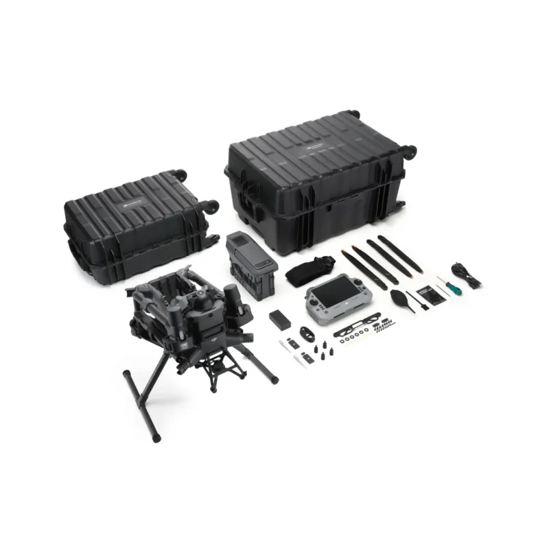
In The BoxComes with the drone, RC Plus 2 with DJI RC Plus 2 sub2G SDR Module, WB37 battery, propellers, and aircraft case, among other accessories. This package does not include the TB100 flight battery or BS100 Battery Station. Purchase separately, or upgrade to the DJI M400 Battery and Charge Station Combo.
-
DJI Care Enterprise Plus IncludedDJI Care Enterprise Plus entitles you to unlimited replacements for free for a year. A renewal option is available.
-
Why Livdrone™Lifetime assistance and blanket access to our 35+ in-house team, including accredited technicians, consultants, surveying division, regulatory specialists/UK SORA consultancy, training instructors, account managers, and solutions engineers.
Strong battery life, dust and water resistant
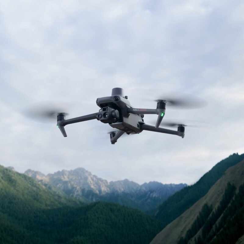
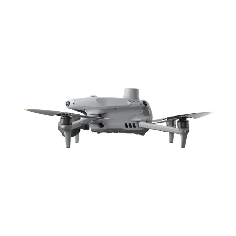
The Matrice 400 has a forward flight endurance of up to 59 minutes and a hovering endurance of up to 53 minutes , and has an IP55 protection rating

Load capacity upgrade to support multiple loads
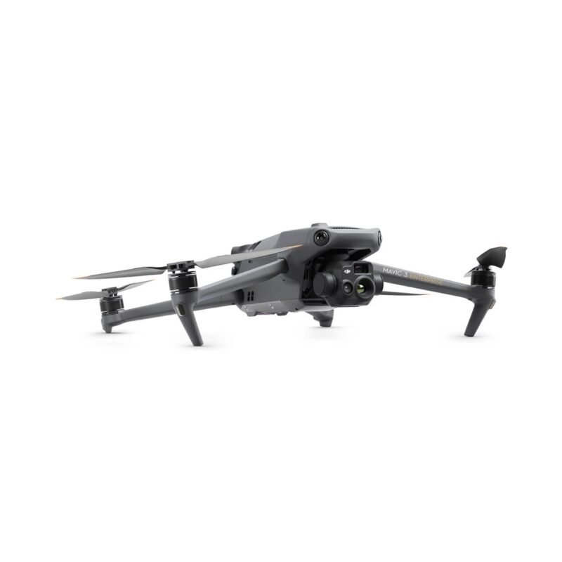
Matrice 400 can be equipped with DJI official gimbal cameras, searchlights, megaphones, Magic 3 or third-party payloads according to different mission requirements. It can carry up to 7 payloads at the same time, with a maximum load weight of 6 kg , making it easy to cope with a variety of scenario requirements.

Wire-level obstacle avoidance makes flying safer
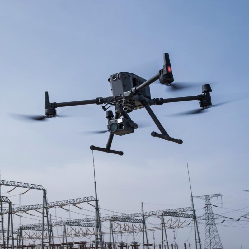
Matrice 400 is equipped with a circular scanning laser radar and a high-precision millimeter wave radar, which can avoid high-voltage power lines across the mountains at night [3] . It also supports the O4 industry-enhanced image transmission and aerial image transmission relay [4] , making operations easier.
Intelligent support, improved efficiency
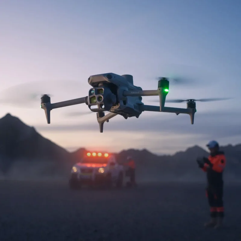
Matrice 400 supports visible light and thermal imaging model detection, intelligent AR projection, real-time terrain simulation , shipboard takeoff and landing , and supports intelligent flight functions such as constant speed, flight direction, tracking, and circling. Combined with the powerful computing power of Matrice 3, it can improve the efficiency of various operations.
Full-Frame sensor in small body


A new industry standard
Carry up to 7 Payloads with the DJI Matrice 400

-
Endurance and speed: Fly for up to 59 minutes with payload and reach speeds up to 25 m/s.
-
Payload flexibility: Carry up to 6 kg and mount 7 payloads via 4 × E-Port V2 interfaces.
-
Integrated Rotating LiDAR and mmWave Radar: Enables precise obstacle detection at power-line level, enhancing operational safety and accuracy.
-
Reliable transmission: Transmit video up to 20 km (CE/SRRC/MIC).
-
Resilient design: Operates safely in tough conditions with IP55 protection and full-colour vision sensing.
-
Smart detection: Combines visible and thermal imaging for enhanced situational awareness.
-
AR projection: Visualise key data such as lines, maps and routes in real-time for better decision-making.
-
Terrain-aware flight: Maintain altitude with real-time terrain follow for safer and smoother operations.
-
Advanced flight automation: Use Cruise, FlyTo, Smart Track and POI modes for streamlined missions.
-
Maritime ready: Take off and land from ships for flexible deployment in offshore environments.
-
Specialised routing: Follow slopes, geometry, and power lines for efficient, automated data collection.
-
Next-gen power: Brand new smart battery station improves charging and mission readiness.
-
Onboard processing: Manifold 3 computer* delivers 100 TOPS of processing power for AI-driven tasks.
*Sold seperately
-
Longer flights: Achieve up to 59 minutes of forward flight time or 53 minutes of hover time with the Zenmuse H30T payload, a 50% improvement over the M350.
-
High-speed performance: Reach a 25 m/s maximum flight speed and route speed, 60% faster than the M350, for faster mission completion.
-
Vertical agility: Climb at up to 10 m/s and descend at 8 m/s to adapt quickly to changing terrain and conditions.
-
All-weather durability: IP55-rated to operate from -20°C to 50°C in heavy rain, dust, and fog.
-
Reliable video transmission: The O4 Enterprise system supports stable video links up to 20 km under CE/SRRC/MIC conditions, ensuring consistent performance during extended missions (40 km FCC).
-
Dual 4G connectivity: Compatible with two DJI Cellular Dongle 2 modules, enabling automatic network switching for improved signal stability in urban or remote areas.
-
Expanded frequency support: Operates on sub-2G bands for enhanced signal penetration and reliability in complex or congested environments.
-
Advanced antenna design: Equipped with a ten-antenna array on the aircraft and a high-gain phased array antenna on the remote controller to maximise transmission quality.
-
Built-in relay module: One Matrice 400 can act as a high-altitude relay drone, extending communication for another unit operating further away.
-
Airborne relay capability: Supports video transmission via airborne relay, maintaining strong connectivity even across mountainous or obstructed terrain. Compatibilty for using the Matrice 4D as a relay drone coming soon.

Robust Flight Performanc
Maintain long endurance, high speed, and reliable transmission in harsh environments.
-
Flexible payload integration: Carry up to 6 kg using the third gimbal connector.
-
Support up to 7 payloads simultaneously via 4 × E-Port V2 interfaces.
-
Versatile gimbal options: Configure with single, dual, or third downward gimbal connectors for expanded mission setups.
-
Compatibility with Manifold 3, onboard computer with 100 TOPS of processing power, for advanced processing capabilities.
-
Compatible with Zenmuse S1 Spotlight and V1 Speaker for specialised tasks such as search and rescue.
-
Open data interfaces for Drone Payloads, LiDAR, and mmWave Rad.
-
Payload impact on flight time: 59 min with the P1 / L2 / H30T induvidually. 53 min with the H30T and V1 (1 kg). 50 min with the H30T and S1 (1.5 kg). 44 min with 3 kg of payloads. 31 min flight time with 6 kg of payloads.
-
Powerline inspection: When paired with the Zenmuse L2, the system automatically recognises powerline corridors and branch routes. Operators can select a specific line, and the drone will follow it autonomously based on preset parameters. A live 3D point cloud of the corridor is displayed on the remote controller for real-time situational awareness.

High Payload Capacity with Versatile Compatibility,Supports up to 7 payloads with a 6 kg weight limit
-
Power-line-level obstacle sensing: Detects both large and small obstacles, including wires, for safer flights in complex environments.
-
Power-line-level obstacle sensing: Utilises LiDAR and mmWave radar for enhanced obstacle detection.
-
All-weather situational awareness: Maintains sensing performance in low-light, rainy, and foggy conditions for reliable operations year-round.
-
Fusion positioning: Combines multi-sensor data to enhance navigation accuracy and mission precision.
-
Advanced sensing suite: Includes horizontal rotating LiDAR, six-directional mmWave radar, full-colour fisheye vision, upper LiDAR, and downward 3D infrared sensing for full-coverage perception.
-
Integrated positioning: Visual sensors, mmWave radar, and rotating LiDAR work together to provide precise 360° awareness, enabling stable flight near reflective surfaces and safe return-to-home—even without updated home points near buildings, bridges, or terrain.
-
Avoidance modes: Supports both Brake and Avoid functions for flexible response to detected obstacles.
-
High-speed obstacle detection: At 25 m/s, the drone can detect and avoid primary power lines (21.6 mm steel-core aluminium stranded wires) when flying directly toward them.
-
Precision at lower speeds: At 17 m/s, the system can detect and avoid both primary (21.6 mm) and secondary (12 mm) power lines for enhanced safety in dense infrastructure environments.

Safe & Reliable Sensor System,Advanced multi-sensor system delivers precise power-line level obstacle detection—even in low light, rain, or fog.
-
Power-line-level obstacle sensing: Detects both large and small obstacles, including wires, for safer flights in complex environments.
-
Power-line-level obstacle sensing: Utilises LiDAR and mmWave radar for enhanced obstacle detection.
-
All-weather situational awareness: Maintains sensing performance in low-light, rainy, and foggy conditions for reliable operations year-round.
-
Fusion positioning: Combines multi-sensor data to enhance navigation accuracy and mission precision.
-
Advanced sensing suite: Includes horizontal rotating LiDAR, six-directional mmWave radar, full-colour fisheye vision, upper LiDAR, and downward 3D infrared sensing for full-coverage perception.
-
Integrated positioning: Visual sensors, mmWave radar, and rotating LiDAR work together to provide precise 360° awareness, enabling stable flight near reflective surfaces and safe return-to-home—even without updated home points near buildings, bridges, or terrain.
-
Avoidance modes: Supports both Brake and Avoid functions for flexible response to detected obstacles.
-
High-speed obstacle detection: At 25 m/s, the drone can detect and avoid primary power lines (21.6 mm steel-core aluminium stranded wires) when flying directly toward them.
-
Precision at lower speeds: At 17 m/s, the system can detect and avoid both primary (21.6 mm) and secondary (12 mm) power lines for enhanced safety in dense infrastructure environments.

24/7 Obstacle Sensing
Sensing features that excel at different times of day
-
Dual imaging: Combines visual and thermal sensors for precise subject detection.
-
Visual detection: Built-in AI models detect people, vehicles, and boats, with support for alarms, counting, adjustable confidence levels, and third-party model integration.
-
Thermal detection: AI-powered recognition of people, vehicles, and boats using thermal imaging, with adjustable confidence levels and support for people-specific alerts.
-
Terrain follow: Maintains consistent altitude for stable data capture and GSD across manual and automated flights.
-
Smart flight modes: Use Cruise for directional flight without constant input, FlyTo for automatic path and speed adjustment to reach targets efficiently, Smart Track for subject tracking with auto zoom and reacquisition, and POI for orbiting targets to support continuous observation and 3D modelling.
-
Mapping tools: Smart 3D Capture generates rough models and capture routes with visual previews, Observed View displays the camera’s field of view on the map to reduce search workload, Power Line Follow automates linear inspections using the Zenmuse L2, and Route Automation supports slope-based and geometric route planning.
-
DJI FlightHub 2: Pilot from the virtual cockpit, take-off and land, control payloads like the H30, recieve AI detection alerts and perform automated flight routes including waypoint and POI functions.

Smart Flight and Mapping Capabilities
Intelligent automation and visual tools streamline missions and boost accuracy.
-
AR power line display: During power grid inspections, the obstacle sensing system detects frontal wires and displays easily recognisable AR lines on the remote controller screen.
-
AR map view: In urban areas, the controller shows building names, landmarks, and key routes in real time, improving orientation and operational planning.
-
AR flight route: Real-time route previews are shown during Return-to-Home (RTH), FlyTo operations, and obstacle avoidance, allowing for better path monitoring.
-
AR landing shadow: An augmented aircraft shadow appears on-screen during landing, helping the pilot confirm the precise touch-down location.
-
Live annotations: Without requiring 3D modelling, users can mark locations, draw lines to measure distances, and outline areas for size calculations, with all data viewable in FlightHub 2.
-
RC signal direction prompt: When the RC signal weakens, a directional prompt appears on the compass, indicating the aircraft’s position relative to the controller for quick reorientation.
AR Visualisation and Intelligent Guidance,Real-time augmented reality overlays enhance mission awareness, navigation, and data capture.

Packing list

| Option1 |
Option1 |
|---|


Reviews
There are no reviews yet.